Domaine de Sciences et Technologies

-
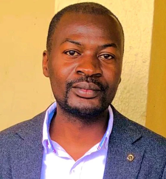
Assistant 1 Nacishali Nteranya Jean
Domaine de Sciences et Technologies
-
Adresse
Bukavu, RDCongo
-
Tel
-
-
Email
j.nacishali@gmail.com
Assistant 1 Nacishali Nteranya Jean
Specialisation: Géologie de l’Environnement et Géomatique Appliquée
Détenteur d’une Licence (Bac+5) en Géologie (Exploration et Géologie Minière) de l’Université Officielle de Bukavu (UOB)/RDC, d’un Diplôme d’Etudes Supérieures (Bac+7) en Forêt & Environnement de l’Université de Kisangani (UNIKIS)/RDC, d’un Certificat en Evaluation d’Impact Environnemental, et actuellement doctorant en Sciences Environnementales (Environmental Planning and Management) à l’University of Eldoret/Kenya. Enseignant et chercheur au Département de Géologie, ses recherches portent sur la gestion durable des ressources naturelles (Ressources minérales, Eau, Sol), la planification environnementale, la géochimie environnementale (Evaluation du risque écologique de la contamination des sols, eaux et sédiments par les métaux lourds) et l’application de la géomatique dans la modélisation des processus géologiques exogènes, de la dynamique des paysages et de la dégradation des terres.
Lire ses publications
Cliquer sur + pour lire la publicationAbstract
Human activity and related land-use/land cover (LULC) changes are the primary causes of accelerated soil erosion during the 21st century. However, there is limited information about the spatiotemporal dynamic of soil erosion under different conditions of LULC changes in mountainous regions of eastern DR Congo. In addition, the impact of landscape structure on soil erosion dynamics has not been assessed yet in this region despite that this information is crucial for sustainable land management. Therefore, the Kalehe territory which is subjected to an upsurge of hydroclimatic risks (erosion, landslides, and flash floods) was used as a case study. The revised universal soil loss equation (RUSLE) modeling was integrated into the GIS environment to assess the synergy between the spatiotemporal changes of LULC and the dynamic of soil loss by erosion during the 1987–2020 period. The historic LULC maps were obtained through the supervised classification of Landsat images. The relationship between the annual soil loss and the landscape characteristics was assessed using the Pearson correlation, principal component analysis, and multiple linear regression model. The results demonstrated that the soil erosion rate has increased over time from 32.08 t/ha/year in 1987 to 44.35 t/ha/year in 2020 due to the changes in landscape structure and composition. The landscape metrics, which significantly influenced the erosion dynamics with composition indices, collectively explained 60.9%, while the landscape structure metrics explained 34.89% of annual soil erosion rate variability in the best fit developed models. The increase in soil erosion is positively influenced by the deforestation, landscape diversity, and land fragmentation but negatively influenced landscape complexity (irregularity of patch’s shape) and patch size. These findings highlight the need for landscape-level management strategies to mitigate soil loss in Eastern DR Congo, emphasizing the importance of maintaining forest cover, preserving larger patches, reducing fragmentation, reducing the landscape diversity, and encouraging complex patch shapes.
Abstract
Land degradation is a major issue for attainment of sustainable development in Eastern DR Congo. This study aims to assess and model the spatial pattern of land degradation vulnerability (LDV) in this region through the application of the Analytical Hierarchy Process (AHP) and geospatial techniques by using the Kalehe territory as a case study. LDV has been defined as the resultant of three components: the exposure to erosion risk, the sensitivity associated with biophysical factors, and the adaptability associated with socioeconomic factors of vulnerability. These factors were weighted using the EasyAHP plugin and multisource open spatial data to obtain the LDV model. This model was validated using the frequency ratio of physical land degradation features. The LDV map was obtained through the application of the weighted overlay technique in QGIS. The results indicated that about 32% of the territory is prone to high to very high vulnerability, representing the hotspot of LDV. The developed model has an overall accuracy of 77.8% in predicting the area with high to very high LDV. Thus, it can be used during land conservation planning to identify the priority areas for implementation of landscape restoration initiatives at the territorial level in Eastern DR Congo.
Abstract
Artisanal mining is one of the activities that mobilizes a large number of people in the Democratic Republic of Congo (DRC) for their livelihoods and survival. However, these activities are carried out without prior environmental impact assessment, leading to consequences such as ecosystem degradation, pollution, loss of biodiversity, and slope instability. In addition, artisanal miners abandon sites after exploitation, but measures are not taken for the remediation and restoration of post-mining degraded land. Therefore, it is essential to develop an integrated approach for the management and the development of alternatives in post-mining areas. In this context, a SWOT (Strengths, Weaknesses, Opportunities, and Threats) and PESTLE (Political, Economic, Social, Technological, Legal, and Environmental factors) analysis of artisanal mining stakeholder roles using a participative approach for the restoration of degraded lands and the development of alternatives in post-mining areas was conducted to support the achievement of the sustainable development goals (SDGs) in the DRC. It appears that the formalization of artisanal mining activities, capacity building of state actors and enabling artisanal miners to adopt low-impact mining techniques, best regulations practices, revalorization of mining tailings and remediation practices will contribute to the reduction of the impact of mining activities on the environment as well as the optimization of mining production. Moreover, artisanal miners, organized in cooperatives for financial inclusion, must be at the center of the process of restoring lands that are degraded by their activities. For this, their opinions and their effective participation must be considered from the planning stage until the execution of the restoration plans.
SYLLABUS DES COURS
Télécharger ses Syllabus
-
Adresse
-
Numéro de Tél: